Elephant corridors are not abstract lines on conservation maps. They are the places elephants repeatedly use to move between larger habitat blocks, water, feeding areas and seasonal ranges.
When those connections remain open, elephants can respond to drought, changing food and social needs. When they narrow or disappear, movement becomes more dangerous and human-elephant conflict often intensifies.
What is an elephant corridor?
A corridor is a landscape connection between larger areas of habitat.
It may be forest, scrub, farmland, plantation, riverbed or a mixture of land uses. What matters is whether elephants can still move through safely and repeatedly.

Why elephants need connectivity
Elephants are wide-ranging animals.
Food, water and reproductive opportunities shift over time, and a population may need access to different parts of its range in different seasons.
Connectivity gives elephants the ability to adjust.
Movement is the reason corridors exist
A corridor is not important because conservationists drew it first.
It is important because elephants are already moving through that landscape.
The strongest corridor planning starts with observed movement, field signs, tracking data and long-term local knowledge.
Corridors can be narrow
Some corridors are broad landscape connections. Others are extremely narrow bottlenecks between settlements, roads or farms.
Those narrow sections are often the most vulnerable because one development can block the entire route.
Corridors can be seasonal
A route used heavily during drought may appear almost empty in the wet season.
Short-term observation can therefore underestimate its importance.
This is why multi-year movement data are particularly valuable.
What happens when a corridor is blocked?
Elephants may reroute through farmland, settlements or infrastructure.
Travel distance can increase, access to water can decline and conflict may shift into new areas.
A blocked corridor does not stop the need to move. It changes where the pressure appears.
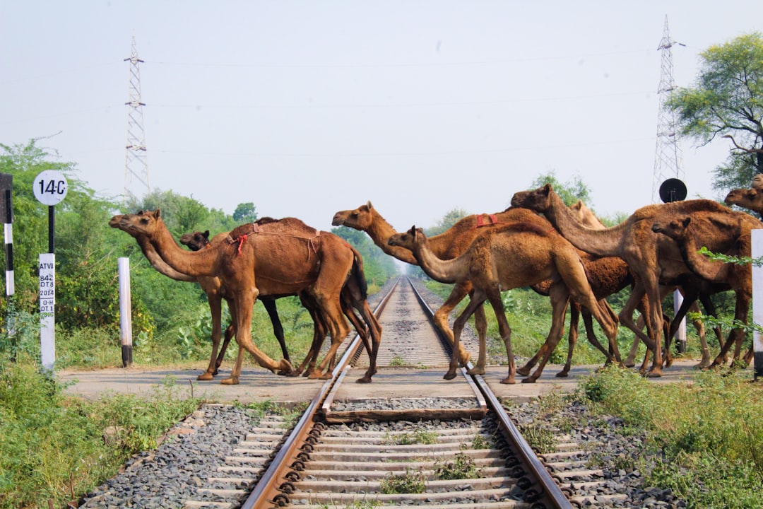
Roads, railways and other infrastructure
Linear infrastructure can cut directly across established elephant routes.
Roads may be crossed at quieter times. Railways can create collision risk. Fences can funnel animals into a smaller number of openings.
Infrastructure therefore has to be assessed in relation to movement rather than only habitat area.
Why underpasses and overpasses need good placement
A wildlife crossing helps only if animals actually use it.
Structures placed away from habitual movement routes may have limited value.
Tracking data, field signs and local knowledge should therefore guide where crossings are built.
Railway mitigation
In India, railway collisions have become a major corridor issue in several elephant landscapes.
Mitigation can include speed restrictions, detection systems, fencing, underpasses and vegetation management.
No single measure works everywhere.
AI detection is only one layer
Real-time detection systems can warn railway staff when elephants approach tracks.
That may reduce immediate collision risk, but it does not restore habitat connectivity by itself.
Technology is most useful when combined with structural mitigation and route planning.
How corridors are identified
Researchers use direct sightings, footprints, dung, local reports, GPS collars, camera traps and historical records.
The more methods agree, the stronger the case that a route is functionally important.
Why local knowledge matters
People living near elephant routes often know which paths animals use repeatedly and how that movement changes by season.
That information can be especially important in landscapes where formal tracking data are sparse.
India’s corridor inventories
India has developed national corridor assessments to identify important movement connections across elephant ranges.
These inventories are useful, but they should be treated as living planning tools rather than permanent maps.
Land use changes, elephant movement changes and some routes become more or less important over time.
Why corridor condition matters
A corridor can still exist on paper while becoming increasingly difficult to use.
Traffic, fencing, noise, settlement and night-time disturbance may reduce permeability even if no single structure fully blocks the route.
Corridor width is not everything
A narrow but quiet route may function better than a wider route full of traffic and fencing.
Quality, disturbance and continuity all matter.
Plantations and working landscapes
Some elephant corridors pass through tea, coffee or other plantations.
These areas can remain permeable if fencing, traffic and settlement allow movement.
They are not equivalent to natural forest, but they may still be critical links.
Corridors and human-elephant conflict
Conflict often rises where movement is squeezed into narrow passages.
Villages or farms near a bottleneck may experience repeated elephant movement simply because few alternatives remain.
This is why conflict management and corridor protection are deeply connected.
Corridors and climate change
Connectivity is also a form of climate resilience.
If drought or heat makes one area less suitable, elephants need the ability to move toward alternative water and forage.
Fragmented landscapes reduce that flexibility.
Corridors and genetics
Movement between populations can maintain gene flow.
If groups become isolated for long periods, genetic diversity can decline and inbreeding risk can rise.
Corridors therefore matter biologically as well as geographically.
Transboundary corridors
Elephants often move across national borders.
Conservation corridors may therefore cross different laws, land-tenure systems and management agencies.
Coordination becomes essential because protection on one side of a border cannot compensate for a blocked route on the other.
Why maps can mislead
A corridor map is a simplification.
Elephant movement is dynamic, and individuals may use several alternative paths rather than one fixed line.
Good planning should preserve movement options, not force every elephant through one narrow channel.
Restoring a corridor
Restoration can involve land purchase, negotiated easements, removal of barriers, safer road crossings or changes in fencing.
The objective is to recover permeability.
That is often easier before development becomes permanent.
Why prevention is cheaper than restoration
Once a route is blocked by dense settlement or major infrastructure, reopening it can be politically and financially difficult.
Protecting a functioning corridor early is therefore usually more realistic than trying to recreate one later.
What good corridor conservation looks like
Strong corridor planning combines:
- verified elephant movement
- land-use mapping
- local community participation
- infrastructure mitigation
- long-term monitoring
- legal or negotiated protection
Why corridors are ultimately about choice
Elephants survive variable landscapes partly because they can move.
A connected landscape gives them options. A fragmented landscape removes those options.
That is the simplest reason corridors matter.
Corridor governance is often the hardest part
The ecological case for a corridor may be clear while the land itself is divided among many owners, agencies or jurisdictions.
Protection can require negotiated easements, land purchase, zoning, compensation or changes to infrastructure design. The biological problem may be simple — elephants need to pass — while the governance problem is anything but.
How do we know a corridor is still working?
A line on an old map is not enough. Researchers need current evidence of use.
GPS data, camera traps, dung, footprints and local observations can show whether elephants still move through the route, whether use is declining, and whether animals are being forced into narrower sections.
Monitoring after protection matters
Designating a corridor is only the beginning. Traffic can increase, new fencing can appear and settlement can expand.
Long-term monitoring is what tells managers whether the corridor remains functional after the original conservation intervention.
What poor corridor planning looks like
A corridor can fail even when land has technically been set aside.
If the route ends at a highway with no safe crossing, if fencing blocks the narrowest section, or if intense lighting and traffic make elephants avoid it, the paper designation has little ecological value.
The test is movement, not paperwork.
Corridors need social legitimacy as well as ecological value
A route can be scientifically important but still fail if local communities carry the costs without influence over planning.
Long-term protection is stronger when landholders, residents and local governments understand why the corridor matters and how restrictions or mitigation will affect them.
Why corridor restoration is often expensive
Once settlement, roads or industry occupy a bottleneck, restoring movement may require land acquisition, engineering changes or negotiated relocation.
That is why protecting a functioning connection early is usually far cheaper than rebuilding one later.
What good corridor monitoring should measure
Managers should track not only whether elephants are present, but how often they use the route, whether crossings are becoming more nocturnal, whether conflict is rising and whether movement is narrowing toward one bottleneck.
Those changes can reveal a corridor under stress before it fails completely.
Why corridor evidence should be refreshed periodically
Movement routes can change as land use, water and disturbance change.
A corridor identified ten years ago may still be essential, may have shifted, or may now be failing. Periodic reassessment keeps planning tied to actual elephant movement.
Why bottlenecks deserve disproportionate attention
A broad landscape connection can depend on one very narrow passage between farms, roads or settlements.
Losing that single point can disconnect much larger habitat blocks, which makes bottleneck protection one of the highest-value conservation interventions available.
What corridor success looks like
A functioning corridor is not merely one where elephants are still present. It is one where movement remains regular, conflict is manageable and elephants can pass without being forced into increasingly risky behaviour.
Why corridor planning needs redundancy
A landscape is more resilient when elephants have more than one viable route between major habitat blocks.
If every movement depends on one narrow passage, a single development, flood or conflict hotspot can sever connectivity.
Why corridors are also emergency routes
During drought, fire or unusual disturbance, elephants may need to use routes that appear unimportant in normal years.
Protecting only the most frequently used path can therefore underestimate the value of alternative connections.
Why corridor protection should be reviewed after major infrastructure change
A new highway, railway or settlement can alter elephant movement even when the original corridor remains technically open.
Post-development monitoring is essential to see whether animals continue to use the route or shift into riskier alternatives.
Related reading
Elephant Movement and Migration — scheduled for 16 February 2027.
Human-Elephant Conflict — scheduled for 1 December 2026.
GPS Collars and Elephant Tracking — scheduled for 19 February 2027.
Why India’s 2026 Elephant Corridor Survey Matters →